

Historical Maps of Missouri
Preview
Type of map
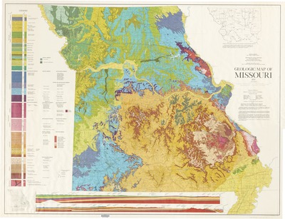
Geological Maps
Description
"The 1979 edition is an extensive refinement of the 1961 map, which was compiled by Mary H. McCracken and the staff of the Geological Survey."
Includes 2 cross sections, inset of "Subdrift and modern drainage relationships in northwestern Missouri," and inset showing hole locations and lines of cross sections.
Scale 1:500,000; 1 in. equals approx. 8 miles.
Geologic mapping by Kenneth H. Anderson [and others] ; editing and cartography under the direction of Jerry D. Vineyard ; Gary P. Clark [and others], artists.
Geographic area
Missouri
Dimensions
103 x 135 cm.
Date published
1979
Publisher
State of Missouri, Department of Natural Resources, Missouri Geological Survey
Place of publication
Rolla, Missouri
Subject Headings
Geology -- Missouri -- Maps
Document Type
Still image - Map
File Type
stillimage
Language
English
Print OCLC #
6533128
Date digitized
1-3-2014
Rights
© 1979 State of Missouri, Department of Natural Resources, Missouri Geological Survey, All rights reserved.
